Calanque de Ratonneau
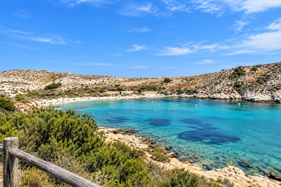
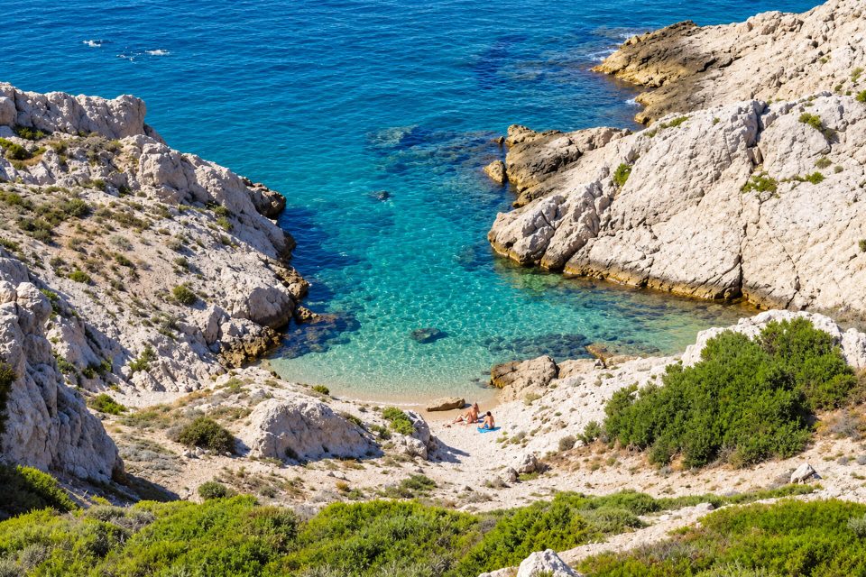
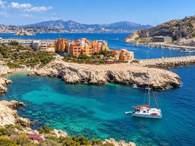
A small fine-gravel inlet at the eastern tip of the island of Ratonneau, half an hour’s walk from the port of Frioul, with no facilities.
Contents · 7 sections
At the eastern tip of the island of Ratonneau, between the Hôpital Caroline and the Cap de Croix, the Calanque de Ratonneau shelters a small fine-gravel inlet below the path. It lies half an hour’s walk from the port of Frioul, at the end of the island, which makes it quieter than Saint-Estève Beach. For self-reliant walkers, without very young children: there are no lifeguards and no facilities.
Why go
- The end of the island: the inlet faces the bay of Marseille, with the Château d’If on the right.
- A swim away from the supervised beach, which is often very busy in summer.
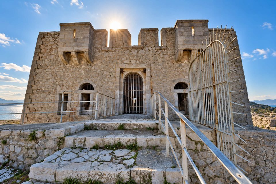
- A walk to combine with the Hôpital Caroline, the Batterie de Croix and the Fort de Ratonneau.
The calanque
The inlet is small and covered in fine gravel, surrounded by limestone rocks. No facilities are listed: no first-aid post, no water point, no toilets, no shade. The City of Marseille does not count it among its supervised bathing areas. Watch out for the name: maps also show a “calanque du Trou de Ratonneau” just to the south; the Calanque de Ratonneau is the one before the tip of the Cap de Croix.
The island itself was called Galiana in Roman times, then Île de Saint-Étienne from the 13th century. The name Ratonneau first referred to its harbour. It is often explained by the Provençal “ratoun”, the little rat, but a Celtic origin linked to the idea of a rampart has also been suggested.
Getting there
- The shuttle boat: the RTM network’s “lebateau” service from the Vieux-Port ferry terminal (1 quai de la Fraternité), daily weather permitting, a crossing of about half an hour. As of 1 November 2026: €17.70 return, €11.50 for residents of the Metropolis with proof of address.
- On foot: from the quay, follow the Chemin de Saint-Estève, go past the beach and then the Hôpital Caroline and carry on for a few dozen metres towards the Cap de Croix; the inlet is below. About 2 km, half an hour.
- The way down is short but a little steep: sturdy shoes are better than sandals.
- By bike, you can go as far as the Hôpital Caroline, but no further: bikes are banned in the archipelago’s natural areas outside the village and this road.
Good to know
- Core of the National Park: stay on the marked paths and do not cut across the vegetation, which includes protected species. Fires, barbecues, picking plants, camping, bivouacking and climbing are prohibited; dogs must be kept on a lead.
- No lifeguards: the Park recommends swimming from the rocks only when the sea is calm. In an emergency, call 112.
- Water and sun: bring at least 1.5 litres of water per person per half-day, a hat and sunscreen. Shops are in the harbour village.
- Fire risk: even on a red day, when the mainland calanques are closed, visiting the Frioul remains possible according to the National Park.
Nearby
On the way back: the Hôpital Caroline, a former lazaretto opened in 1828, which you can walk round without going in; the Calanque de l’Éoube, on the L’Estaque side; Saint-Estève Beach, supervised in season, with its underwater trail; then the Fort de Ratonneau, the island’s highest point, which the National Park includes in its easy loop round Ratonneau.
Sources : Calanques National Park - City of Marseille - lebateau (RTM network), Frioul shuttle boat - Wikipedia, Ratonneau - Plages.tv, Calanque de Ratonneau - OpenStreetMap
Nearby

Times calculated from each guide’s coordinates.
Frequently asked questions
Where is the Calanque de Ratonneau?
At the eastern tip of the island of Ratonneau, on the Frioul, past the Hôpital Caroline, towards the Cap de Croix.
How do you get to the Calanque de Ratonneau?
lebateau shuttle from the Vieux-Port to the port of Frioul, then about 2 km on foot via the Chemin de Saint-Estève and the Hôpital Caroline; the inlet is below, down a short, slightly steep slope.
Is swimming supervised there?
No. The only supervised beach on the Frioul is Saint-Estève, in season.
Are there any facilities?
No: no shade, no water, no toilets. Shops are in the harbour village.
Can you go there by bike?
Only as far as the Hôpital Caroline; beyond that, bikes are banned in the Frioul’s natural areas.