Calanque de Cap Frioul
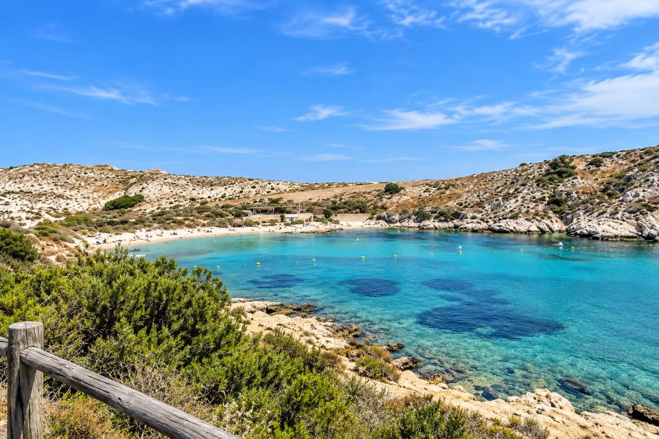
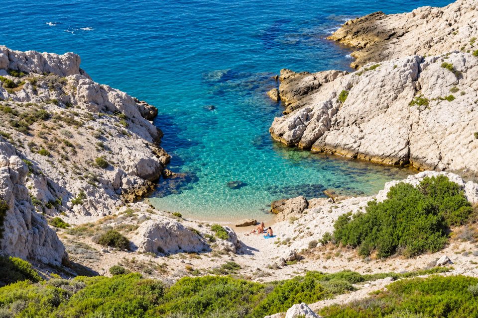
A rocky inlet and a narrow fine-gravel beach at the entrance to Pomègues, a quarter of an hour’s walk from the port of Frioul.
Contents · 7 sections
The Calanque de Cap Frioul is the first inlet you come to on arriving on the island of Pomègues, just after the Digue Berry. It opens to the west, onto the Baie du Grand Soufre, at the foot of the cape that gives it its name. Little documented and without a real beach, it mainly appeals to those who want to swim from the rocks a quarter of an hour from the harbour, or who are starting the Pomègues hike.
Why go
- The Pomègues inlet closest to the harbour: about a kilometre of track from the landing stage.
- A stop on the Pomègues hike: the Tourist Office places it just after the Digue Berry, at the start of the route that leads to Cap Caveaux.
- A historical detail: an old stone wall runs along the calanque. According to the Tourist Office, it may have served either to hold back the soil and protect crops from the mistral, or to prevent a landing.
The calanque
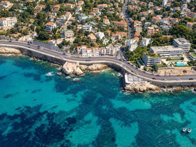
The site has two ways down. The first leads to a rock-covered inlet, not very comfortable for lying down. The second leads to a very narrow beach with a little fine gravel. Either way, bring shoes for getting into the water. No facilities, no shade and no lifeguards: on the archipelago, only Saint-Estève Beach has a first-aid post in summer.
The calanque is called “calanque de Cap Frioul” on the National Park map and “calanque du Cap de Frioul” on OpenStreetMap. The name Frioul originally referred to the sea passage between Pomègues and Ratonneau.
Getting there
- By boat to the port of Frioul: Le Bateau Frioul If shuttle, operated by RTM, leaving from the ferry terminal on the quai de la Fraternité (Vieux-Port), every day weather permitting. A crossing of 20 to 35 minutes depending on whether or not the boat stops at the Château d’If. Full-price return: €17.70 (fare as of 1 November 2026).
- On foot: from the landing stage, follow the quay westwards, cross the Digue Berry, about 300 m long, then follow the Pomègues track. The ways down to the calanque are shortly after the island’s sewage treatment plant, on the right. Allow about 1 km and a quarter of an hour, on flat ground.
Good to know
- Stay on the marked paths: a municipal order of 5 February 2021 and the National Park regulations prohibit walking off the paths on Ratonneau and Pomègues.
- Dogs on a lead throughout the archipelago; cycling and climbing banned outside the village.
- Water: there is no drinking fountain on Pomègues. Fill your bottles before leaving the village.
- Gulls: from March to July, they nest on the ground near the paths and may dive at walkers who get too close to their nests.
- Protected plants: pick nothing, especially the sea daffodil (lys des sables), which is rare and protected.
Nearby
Just to the north, on the other side of the breakwater, Grand Soufre Beach offers a gentler way into the water. Continuing along the track, you reach the Tour du Pomèguet and the port of Pomègues, a former quarantine harbour that is now home to a fish farm, then the Calanque de l’Huile and, at the end of the Sentier des Astragales, the Calanque de la Crine.
Sources : Calanques National Park - Marseille Tourist Office - Le Bateau Frioul If (RTM) - Wikipedia, Archipel du Frioul - Wikipedia, Pomègues - OpenStreetMap - Plages TV guide
Nearby
 Calanque du Port de Pomègues≈ 5 min on footGrand Soufre Beach≈ 10 min on foot
 Calanque de l’Huile≈ 10 min on foot
Times calculated from each guide’s coordinates.
Frequently asked questions
Where is the Calanque de Cap Frioul?
On the island of Pomègues, just after the Digue Berry, on the west side, facing the Baie du Grand Soufre.
How long is the walk from the port of Frioul?
About a quarter of an hour, or roughly 1 km via the quay, the Digue Berry and the Pomègues track.
Is there a beach at the Calanque de Cap Frioul?
A very narrow beach with a little fine gravel, and a rocky inlet. Water shoes are useful.
Does the Calanque de Cap Frioul have lifeguards?
No. On the Frioul, only Saint-Estève Beach has a first-aid post in summer.
Can you bring your dog?
Yes, on a lead, as throughout the Frioul archipelago.